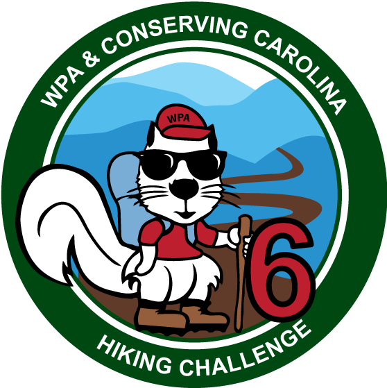
Update: Hiking Challenge 6 is now complete, although you are welcome to do these hikes for your own enjoyment. We also invite you to participate in White Squirrel Hiking Challenge 7, launched in Oct. 2023.
Hiking Challenge 6 is here! In Conserving Carolina’s and WPA’s White Squirrel Hiking Challenge 6, you get to explore the places you’re helping to protect—and they’re amazing! We invite you to take eight hikes on lands that Conserving Carolina has helped to protect, enhance, or open to the public.
This challenge includes two all-new Conserving Carolina trails with gorgeous views! Plus, you can see the highest waterfall east of the Rockies, lakes and waterfalls in DuPont State Recreational Forest, expanded trails in Bracken Mountain Preserve, and a beautiful creek in the Green River Game Lands. There’s also the all-time favorite Bearwallow Mountain with its 360-degree views over the mountains and countryside we’re working to protect.
These hikes will take you to some of our region’s “greatest hits,” as well as hidden gems where you may have the woods to yourself. If you’re into mountain biking, you have the option of biking some of these trails. And if you love to swim, fish, or just be near the water, five of these hikes take you to rivers, lakes, or waterfalls.
And the Hikes Are…
Drumroll please…. Here are the 8 hikes for this new Hiking Challenge! You can find more information and links to the full hike descriptions below. Which one will you do first?
- Bearwallow Mountain
- Wildcat Rock Trail – Extended
- Bracken Preserve
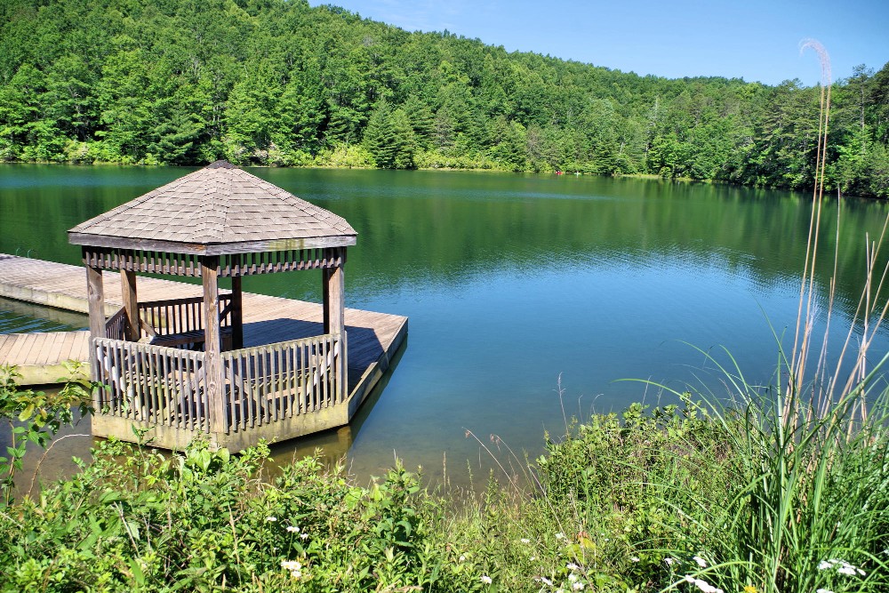
- DuPont State Recreational Forest: Fawn Lake and Lake Julia
- DuPont State Recreational Forest: Holly Road to Hooker Falls
- Green River Game Lands: Green River Cove Trail
- Whitewater Falls
- Youngs Mountain Trail
How to Become a Hiking Challenge Champion
Are you ready to get hiking? It’s easy to get started. Just look over the list of hikes, choose what you want to explore first, then follow the links for detailed information so you can plan your hike. Have a wonderful day exploring the great outdoors.
Log each hike as you complete it. You can check your progress in this roster.
- You can do the hikes at your own pace. You can take weeks, months, or over a year—whatever works for you.
- You must complete all your hikes before the start of the next Hiking Challenge. We launch a new challenge about every two years.
- Only hikes that you’ve done after Oct. 1, 2021 count toward Hiking Challenge 6.
- You can complete the hikes on your own or as a group.
- Please share about your hikes with the hashtag #whitesquirrelhikingchallenge (optional)
- Feel free to share about your hikes and connect with other hikers in our Facebook group, the Conserving Carolina Community.
The Hiking Challenge is free and open to all, but you must be a Conserving Carolina member to become a Hiking Challenge 6 Champion. If you are a member and you complete all 8 hikes, you will earn your White Squirrel Patch and exclusive perks from local businesses that support conservation, including Appalachian Coffee Company, Lazy Otter Outfitters, Murphy’s Naturals, and YAM Yoga and Massage. Most importantly, you get to experience eight great places and deepen your personal connection to land conservation.
Thank You, Witherspoon Platt & Associates!
Hiking Challenge 6 is brought to you by Witherspoon Platt + Associates (WPA)—a full service, conservation-focused real estate firm that connects people to the beauty, history, and culture of Western North Carolina through both the built environment and land protection. We are so grateful for their support of land conservation!
![]()
More Challenges from Conserving Carolina
If you love to get outside, you may also be interested in our Flying Squirrel Outdoor Challenge. The Flying Squirrel Challenge offers more flexibility in the kinds of activities that you take on, such as walking a greenway, hiking a mountain, riding a bike, paddling a river, forest bathing, or volunteering outdoors. It includes options that are accessible to people of all abilities, so everyone can take on this challenge.
All previous versions of the Hiking Challenge are officially closed, as far as logging your hikes and earning your patches. However, if you want to explore hikes from previous challenges for your own enjoyment, you can find the archives for Hiking Challenge 4 here and Hiking Challenge 5 here.
Explore 8 Amazing Hikes—All on Land You’re Helping to Protect!
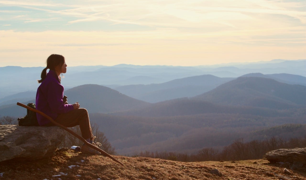
Bearwallow Mountain
Fairview, NC
2 miles round-trip (or combine with Wildcat Rock Trail for a longer hike)
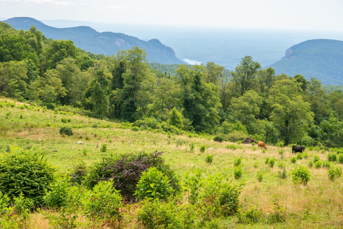
Bearwallow Mountain is the one hike that’s featured in every Hiking Challenge—for good reason! A short hike takes you to a grassy, open mountaintop with nearly 360-degree views. You can take in panoramic vistas including Mt. Mitchell, Mt. Pisgah, the Hickory Nut Gorge, Hendersonville, and the high country of South Carolina. Bearwallow is actually part of a working farm so you may see cattle grazing on the mountaintop.
Conserving Carolina holds a conservation easement on 476 acres, ensuring that this beautiful mountain will never be developed. We also maintain the popular hiking trail. This trail was the first step toward the 100+ mile Hickory Nut Gorge State Trail that we are spearheading—now with almost 40 miles open to the public! A new section of trail now connects Bearwallow and Wildcat Rock Trail, so if you want, you can combine these two hikes as a 6-mile shuttle hike or a strenuous out-and-back.
Wildcat Rock Trail – Extended!
Gerton, NC
6 or 10 miles, depending on which option you choose
In 2020, Conserving Carolina opened a new two-mile section of trail that extends the Wildcat Rock Trail all the way to the summit of Bearwallow Mountain! Highlights include a ridgeline meadow with views of the Hickory Nut Gorge and beautiful boulder fields. You can reach this new section of trail in several ways. Here are your options:
- Option #1: 6 mile out-and-back starting at Bearwallow Mountain. Combine this hike with Bearwallow Mountain. Start at the Bearwallow Mountain trailhead. Hike 1 mile to the summit of Bearwallow, then continue downhill for 2 miles until you reach the ridgeline pasture on Little Bearwallow Mountain. Enjoy the view, then turn around.
- Option #2: 10-mile out-and-back starting at the base of Wildcat Rock. Start at the base of the Wildcat Rock Trail. Hike up the steep trail, past the 50-foot waterfall and dramatic rock outcrop until you reach the ridgeline pasture on Little Bearwallow Mountain after about 3 miles. Then continue upward another 2 miles until you reach the summit of Bearwallow. Enjoy the view, then turn around.
- Option #3: 6-mile shuttle hike starting at either Bearwallow or Wildcat Rock. Do a shuttle hike combining Bearwallow Mountain Trail and all of Wildcat Rock Trail. Start at either trailhead, while leaving a vehicle at the other. If you start at Bearwallow, you’ll be hiking mostly down. If you start at the base of Wildcat Rock, you’ll be hiking mostly up.
You can learn more about hiking Wildcat Rock Trail here, including a map of the expanded Upper Hickory Nut Gorge Trail System.
Bracken Preserve
Brevard, NC
7.2 mile loop
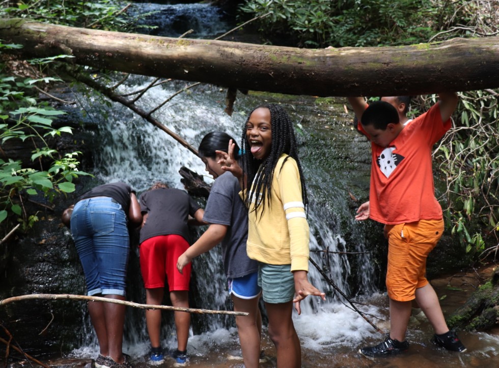
Trails in Bracken Preserve create a direct link between the City of Brevard and Pisgah National Forest. And the trail system was expanded in 2019 with help from Conserving Carolina volunteers. The preserve offers several loops for hikers and bikers, including a series of small waterfalls. This hike starts out very steep before becoming more moderate.
Conserving Carolina volunteers helped build the new 1.5 mile Pinnacle Trail. For the Hiking Challenge, be sure to include the Pinnacle Trail, marked with pink blazes, at the highest part of the trail system. Look for signage near the parking area about the incredible history of the Black and Native people who founded the Pinnacle community, for which this trail is named. You can complete this part of the Hiking Challenge by either hiking or mountain biking.
DuPont State Recreational Forest: Fawn Lake and Lake Julia
Cedar Mountain, NC
4 mile loop
DuPont State Recreational Forest is one of our region’s most treasured destinations. This hike takes you along some of the quieter trails in the popular forest. In four miles of relatively gentle terrain, you will see two beautiful lakes and gorgeous mountain views from the opening cleared for an (rarely used) airstrip. At the lakes, feel free to enjoy the peaceful viewing areas, go fishing, or go for a swim on a warm day. You can complete this hike either on foot or by bike. The trails here are wide and gentle, making them suitable for beginner mountain bikers.
Conserving Carolina is proud to have played a major role in the conservation of DuPont State Recreational Forest. In fact, it’s how we got our start as a land trust! We’ve gone on to help protect thousands of acres of private land adjoining the state forest. And recently we added the 717-acre Continental Divide Tract, linking DuPont to a 100,000+ acre conservation corridor!
For this hike, please see the hike description from our friends at Romantic Asheville. There is a trail map here that you can print or download to your phone before you go.
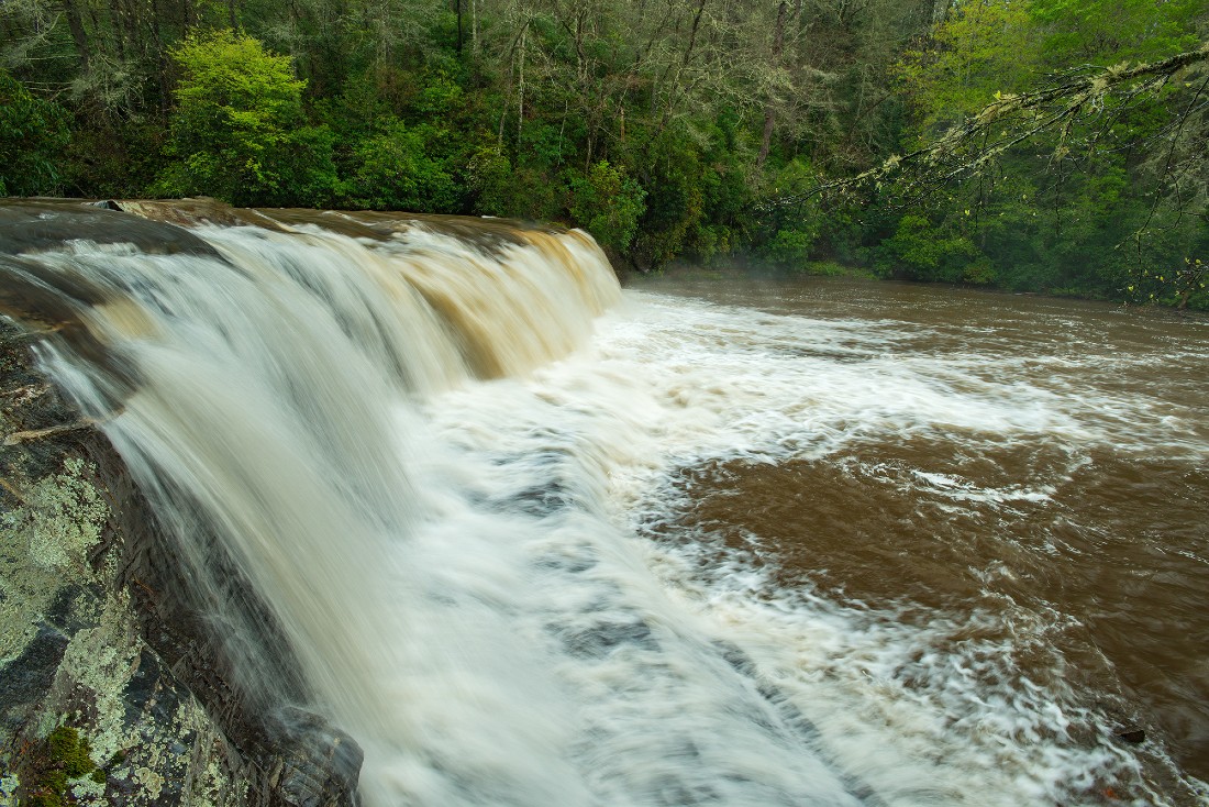
DuPont State Recreational Forest: Holly Road to Hooker Falls
Southeast of Brevard
3.6 mile out-and-back
This hike takes you on a new route to one of our region’s favorite waterfalls. Conserving Carolina’s Trails Specialist, Peter Barr, provided his trail expertise in the design of this new, sustainable reroute of the original Hooker Falls Trail. In this hike, you start at the Lake Imaging access area and hike Holly Road until you reach the Hooker Falls access area and then follow the new loop trail to the waterfall. After you complete the Hooker Falls loop, follow Holly Rd. back the way you came, for an approximately 3.6 mile hike.
Hooker Falls is beautiful at all times and in the summer, it’s a popular spot to swim so bring your bathing suit if you want to jump in. Please note that the waterfall is very popular. To avoid crowding, try to visit at off-peak hours (weekdays rather than weekends if possible; early mornings and late afternoons rather than the middle of the day.)
We have two DuPont hikes in this challenge because DuPont is a big place with a lot to explore. It also means a lot to Conserving Carolina since we’ve been steadily protecting land there from the 1990s through today. We’re proud to have helped create this recreational gem in WNC!
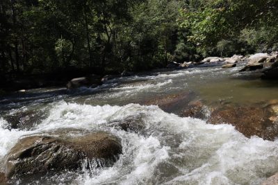
Green River Game Lands: Green River Cove Trail
North of Saluda
6.5 miles round trip
The Green River Game Lands contain a network of 9 different trails, including the 6.5 mile out-and-back Green River Cove Trail. The trek follows the beautiful Green River for its entire length, so you can enjoy this rushing, wild river as well as views of nearby mountains. The Game Lands are also home to a diverse array of rare plant and animal species, as well as one of the highest densities of nesting birds in North Carolina.
The Green River Game Lands keep getting better, with new conservation lands added by Conserving Carolina. Among these, we added 600 acres at Little White Oak Mountain in 2018 and we hope to add another 78 recently protected acres on Macedonia Road to the Game Lands.
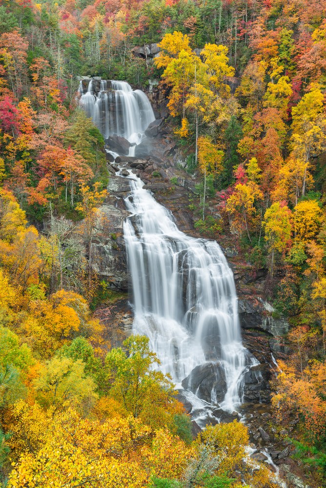
Whitewater Falls
West of Gorges State Park on NC/SC Border
1.5 miles round trip
Plunging more than 800 feet, the gorgeous Whitewater Falls is the highest waterfall east of the Rockies! For this hike, first walk a quarter-mile to the upper overlook. Then follow the stairs down to the lower overlook to take in another stunning view. Then, follow the spur trail that goes for another half-mile to the base of the falls at the Whitewater River. If you are eager to keep hiking, you can follow the Foothills Trail along the river toward South Carolina. However, to complete this part of the Hiking Challenge, you just need to make your way down to the river and back, a total of about 1.5 miles.
Conserving Carolina is proud to have recently purchased an inholding of private land within Nantahala National Forest, upstream of the waterfall. Although there is not public access to this land at this time, conserving it helps to keep the Whitewater River pristine and the forest surrounding it intact.
Please note that the trail to the base of the falls can be slippery in wet weather, so pay attention to weather conditions as you plan your hike. There is a fee of $3 to park at the trailhead. You can find the trailhead on Google Maps here. For more information on this hike, see this detailed description from Romantic Asheville.
Youngs Mountain Trail
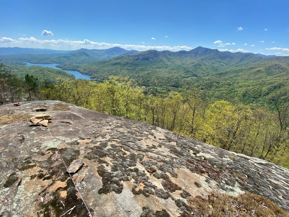
North of Lake Lure
4.2 miles round trip
The spectacular Youngs Mountain Trail is the newest link in the Hickory Nut Gorge State Trail that Conserving Carolina is spearheading. This sustainably built trail begins by winding through a beautiful forest, crossing several creeks. Then climb get steeper and takes you to several overlooks, including an overhanging rock that makes a great place for photos. From the rocky summit, you can take in panoramic views of Lake Lure, Rumbling Bald, Weed Patch Mountain, the lower Hickory Nut Gorge, Mt. Mitchell and the Black Mountains. After you enjoy these beautiful vistas, follow the trail back the way you came, noting the rich diversity of plants and animals along your way.
Please note that this trail takes you along cliffs and precarious rock outcrops. Please approach these areas with great caution. Keep a close watch over children and pets, or leave them at home for this hike. Parking is very limited and you must register for a free parking pass.
Share and Connect
We love to see your photos and stories! Please post with the hashtag #whitesquirrelhikingchallenge so we can keep up with your adventures. Also the Conserving Carolina Facebook group is a great place to share about our hikes and connect with other folks doing the White Squirrel Hiking Challenge.