In March 2026, the Town of Lake Lure announced the partial reopening of Weed Patch Mountain Trail! The trail had previously been closed due to extensive damage from Hurricane Helene. Hikers are now able to take on the rugged 10-mile round-trip hike to the stunning Grey Rock viewpoint, as an out-and-back from Buffalo Creek Park. Or you can go for a shorter hike along any portion of this trail network, including the new Upper Boulders Trail.
The following trails in this area are now open to the public:
- Right fork of the Buffalo Creek Park Trail
- Weed Patch Mountain Trail to the Grey Rock overlook
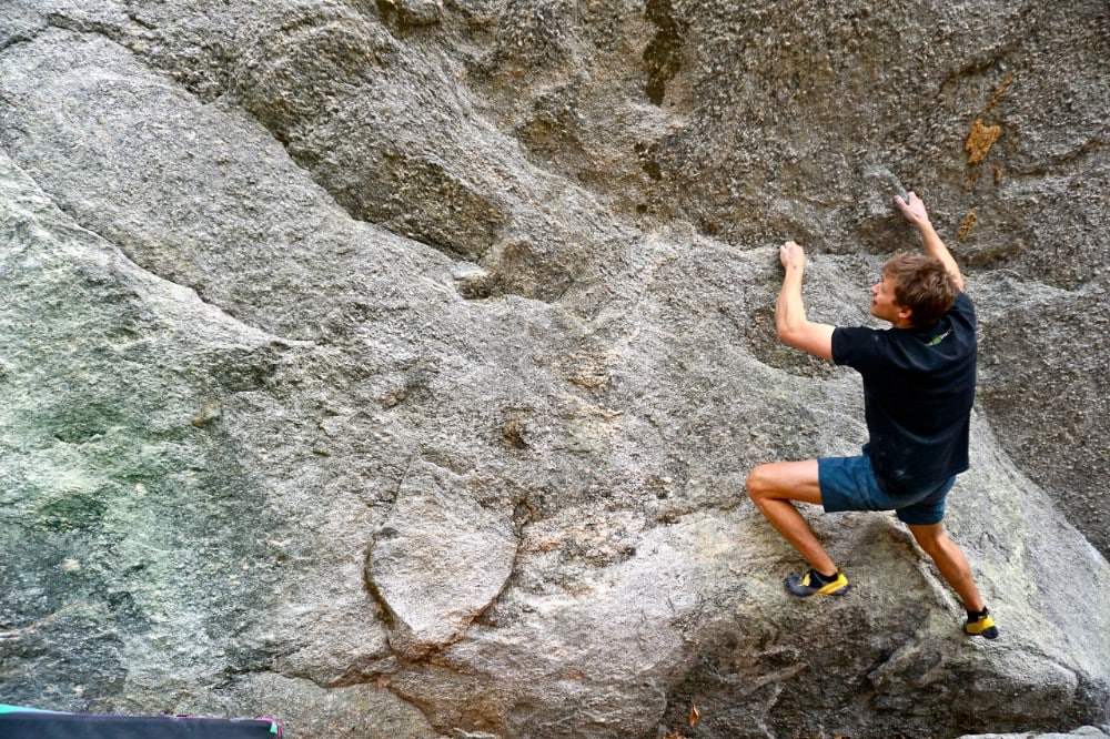
- Upper Boulders Trail—a steep and rocky new trail that provides rock climbing access
Please note that the parking area on Shumont Rd. is closed. You can access Weed Patch via Buffalo Creek Park. Conserving Carolina is working with the Town of Lake Lure and NC State Parks toward a solution that will provide access to the northern endpoint of Weed Patch Mountain Trail.
Length: 10 miles round-trip from Buffalo Creek Park to Grey Rock
Difficulty: Strenuous (with shorter and more moderate options available)
Great For: Hiking, Mountain Biking, Rock Climbing, Views, Wilderness Experience
Protect Great Places to Get Outside!
If you enjoy places like Weed Patch Mountain Trail, become a member of Conserving Carolina! We’re always working to create new parks, trails, greenways, and public lands. Your membership supports conservation and we’ll keep you in the loop about the latest news, outings, and events.
How to Get to Weed Patch Mountain Trail
Please note that the parking area on Shumont Road has been closed. You can access Weed Patch Mountain Trail via the Town of Lake Lure’s Buffalo Creek Park.
Buffalo Creek Park Trailhead
Address: 2191 Buffalo Creek Rd, Lake Lure, NC 28746
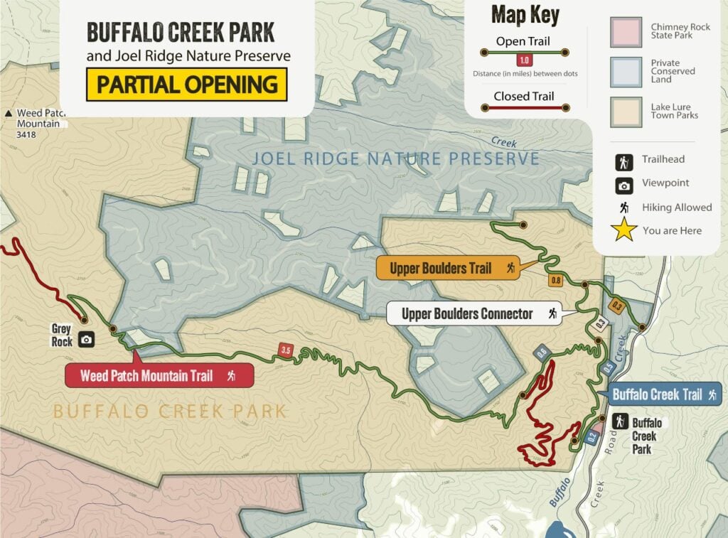
Weed Patch Mountain Trail Map
The Town of Lake Lure has released this map of currently open trails in Buffalo Creek Park. Trails in green are now open, while trails in red are closed.
Hiking and Biking in Buffalo Creek Park
Weed Patch Mountain Trail is part of a growing network of trails located in and around the Town of Lake Lure’s Buffalo Creek Park. Current options in the park include:
Weed Patch Mountain Trail to Grey Rock (Hike or Bike)
Weed Patch Mountain Trail is a challenging but exceptionally scenic trail that is open for hiking and mountain biking.
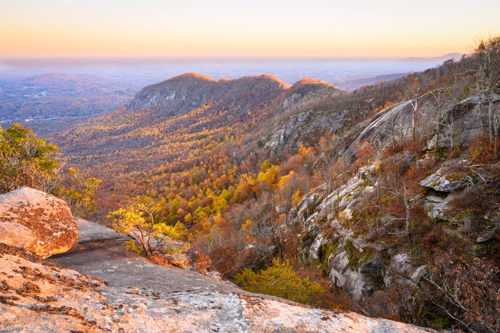
Before you start, please be aware that the trail is steep and rugged and the 10-mile round-trip to Grey Rock is a very strenuous hike or a challenging mountain bike ride. If you are taking Weed Patch, be prepared with food, water, layers, and other essential supplies. For those who do take on this challenging trail, you will be rewarded with spectacular views from Grey Rock, including the rocky slopes of Rumbling Bald in Chimney Rock State Park.
- Start at Buffalo Creek Park.
- Take the Buffalo Creek Park Trail about 1.3 miles to the intersection with the Weed Patch Mountain Trail.
- Then, take Weed Patch Mountain Trail almost four miles to the Grey Rock overlook.
- To return, turn around and head back the way you came.
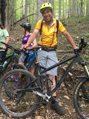
Buffalo Creek Trail (Hike or Bike)
The Buffalo Creek Trail offers a moderate hike or mountain bike ride on rolling trails with significant climbs. It is approximately 2.6 miles round-trip from the parking lot to the intersection with Weed Patch Mountain Trail. The trail is a bike-optimized flow trail with bermed corners and numerous switchbacks. It offers occasional views of Lake Lure and the surrounding mountains. This is an out-and-back, so when you reach the end of the trail, turn around and head back to the parking area.
Upper Boulders Trail and Connector (Hike Only)
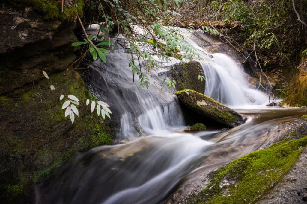
The Upper Boulders Trail is a new trail that opened to the public in March of 2026! From Buffalo Creek Park, it is a 3.6-mile round-trip on a steep, rocky trail that provides access for rock climbing and bouldering, with creeks, wildflowers, and a scenic cliff-top view. Conserving Carolina worked with Carolina Climbers Coalition to create both the Upper Boulders Trail and the Upper Boulders Connector. This trail is open for hiking but not mountain biking.
Here’s how to hike this trail starting at Buffalo Creek Park, for a 3.6-mile round-trip hike:
- Start at the Buffalo Creek Park parking lot.
- Take Buffalo Creek Trail for 0.7 miles.
- Turn right on the Upper Boulders Connector and take it for 0.3 miles.
- Turn left on Upper Boulders Trail and take it 0.8 miles to the top of the trail.
- Turn around and return to the parking lot the way you came.
Buffalo Creek Park Trail Rules
- Keep pets on leash and under control.
- Do not litter. Pack in, pack out. This includes pet waste.
- Watch out for others. Bikers, ride under control. Look out for hikers, slow down when you see them, and be prepared to stop. Yield to hikers and uphill traffic.
- Be prepared. Weed Patch Mountain Trail is much longer, more remote, and more challenging than the Buffalo Creek Park trail. Only take this trail if you are ready for a rugged backcountry experience.
- Stay on the trail. Do not take side roads or paths, which access private property and are for emergency access only.
- No overnight camping.
- No campfires.
- No alcohol.
- Do not use muddy or wet trails. To prevent trail damage, do not hike or bike in these conditions.
Creating the Weed Patch Mountain Trail
Conserving Carolina partnered with the Town of Lake Lure to protect over 1,500 acres at Buffalo Creek Park—making it one of the largest local parks in North Carolina. This land was slated for development as part of the GreyRock neighborhood, but during the recession, plans for the development were downsized and we were able to purchase the property out of bankruptcy. This allowed us to save a stunning tract of backcountry wilderness and open it to the public for recreation!
Conserving Carolina protected the land forever with a conservation easement and sold it to the town for a public park. We designed and built the trail to high standards of sustainability, in order to prevent erosion, minimize needs for future maintenance, and enhance people’s experience on the trail.
In 2019, the national Coalition for Recreational Trails honored Weed Patch Mountain Trail with its annual achievement award in the category of trail design and construction. Learn more.
The complete Weed Patch Mountain Trail extends 8.6 miles, connecting with the Buffalo Creek Trail for a full 10 miles of trail. However, at this time, only the lower portion of Weed Patch Mountain Trail is open. Conserving Carolina is working with the Town of Lake Lure and NC State Parks to restore access to the full trail.
The Weed Patch Mountain Trail is part of our vision for the 100+ mile Hickory Nut Gorge State Trail network. Since building Weed Patch Mountain Trail, Conserving Carolina has gone on to purchase more land from the downsized GreyRock neighborhood. Now, more than 2,669 acres of gorgeous mountain wilderness are protected in Buffalo Creek Park and the adjacent Joel Ridge Nature Preserve, which is owned by Conserving Carolina. We plan to open future trails in Joel Ridge Nature Preserve, expanding this exciting trail network.
Share Your Experience
If you’ve been out adventuring on Weed Patch Mountain, please share your photos on Facebook, Instagram, or Twitter. Tag us and use the hashtag #conservingcarolina. Here’s how to find us on social:
Keep Exploring
Love Weed Patch? What’s the next great place for you to discover?