Hiking Challenge 8 is here! In Conserving Carolina’s White Squirrel Hiking Challenge 8, we invite you to take eight amazing hikes on lands that Conserving Carolina and our partners have protected for everyone to enjoy.
Have you been out to Bell Park yet? Or have you had a chance to walk the first 6 miles of the Ecusta Trail? Have you experienced the grand views of Bearwallow Mountain or Rumbling Bald? This year’s hiking challenge will take you to these extraordinary places—plus a waterfall in Pisgah National Forest, and a tranquil trail in DuPont. We have an amazing combination of new trails and iconic protected places lined up for this year’s challenge!
The Hiking Challenge is a self-guided adventure that you can do in any order, at your own pace. To share your photos and connect with other hikers, join the Conserving Carolina Community group on Facebook. The Hiking Challenge is open to everyone, but only Conserving Carolina members can become a Hiking Challenge Champion, earning their white squirrel patch and perks from local businesses. Ready to get started?
Up for a Challenge?
Here are the 8 hikes for this new Hiking Challenge! You can find more information and links to the full hike descriptions below. Which one will you do first?
- Bearwallow Mountain
- Bell Park
- Little White Oak Mountain
- The Ecusta Trail
- Chimney Rock: Rumbling Bald
- Pisgah: Cat Gap
- DuPont: Mine Mountain, Cart Trail, Laurel Ridge
- White Oak Trail
How to Become a Hiking Challenge Champion
Are you ready to get hiking? It’s easy to get started. Just look over the list of hikes, choose what you want to explore first, then follow the links for detailed information so you can plan your hike. Have a wonderful day exploring the great outdoors!
Log each hike as you complete it. You can check your progress in this roster.
- You can do the hikes at your own pace. You can take weeks, months, or over a year—whatever works for you.
- You must complete all your hikes before the start of the next Hiking Challenge. We launch a new challenge about every two years.
- Only hikes that you’ve done after Oct. 1, 2025 count toward Hiking Challenge 8.
- You can complete the hikes on your own or as a group.
- Please share about your hikes with the hashtag #whitesquirrelhikingchallenge (optional)
- Feel free to share about your hikes and connect with other hikers in our Facebook group, the Conserving Carolina Community.
The Hiking Challenge is free and open to all, but you must be a Conserving Carolina member to become a Hiking Challenge 8 Champion. If you are a member and you complete all 8 hikes, you will earn your White Squirrel patch. Most importantly, you get to experience eight great places and deepen your personal connection to land conservation.
More Challenges from Conserving Carolina
If you love to get outside, you may also be interested in our Flying Squirrel Outdoor Challenge. The Flying Squirrel Challenge offers more flexibility in the kinds of activities that you take on, such as walking a greenway, hiking a mountain, riding a bike, paddling a river, forest bathing, or volunteering outdoors. It includes options that are accessible to people of all abilities, so everyone can take on this challenge.
All previous versions of the Hiking Challenge are officially closed, as far as logging your hikes and earning your patches. However, if you want to explore hikes from previous challenges for your own enjoyment, you can find the archives here for Hiking Challenge 7, Hiking Challenge 6, Hiking Challenge 5, and Hiking Challenge 4.
Explore 8 Amazing Hikes—All on Land You’re Helping to Protect!
Bearwallow Mountain
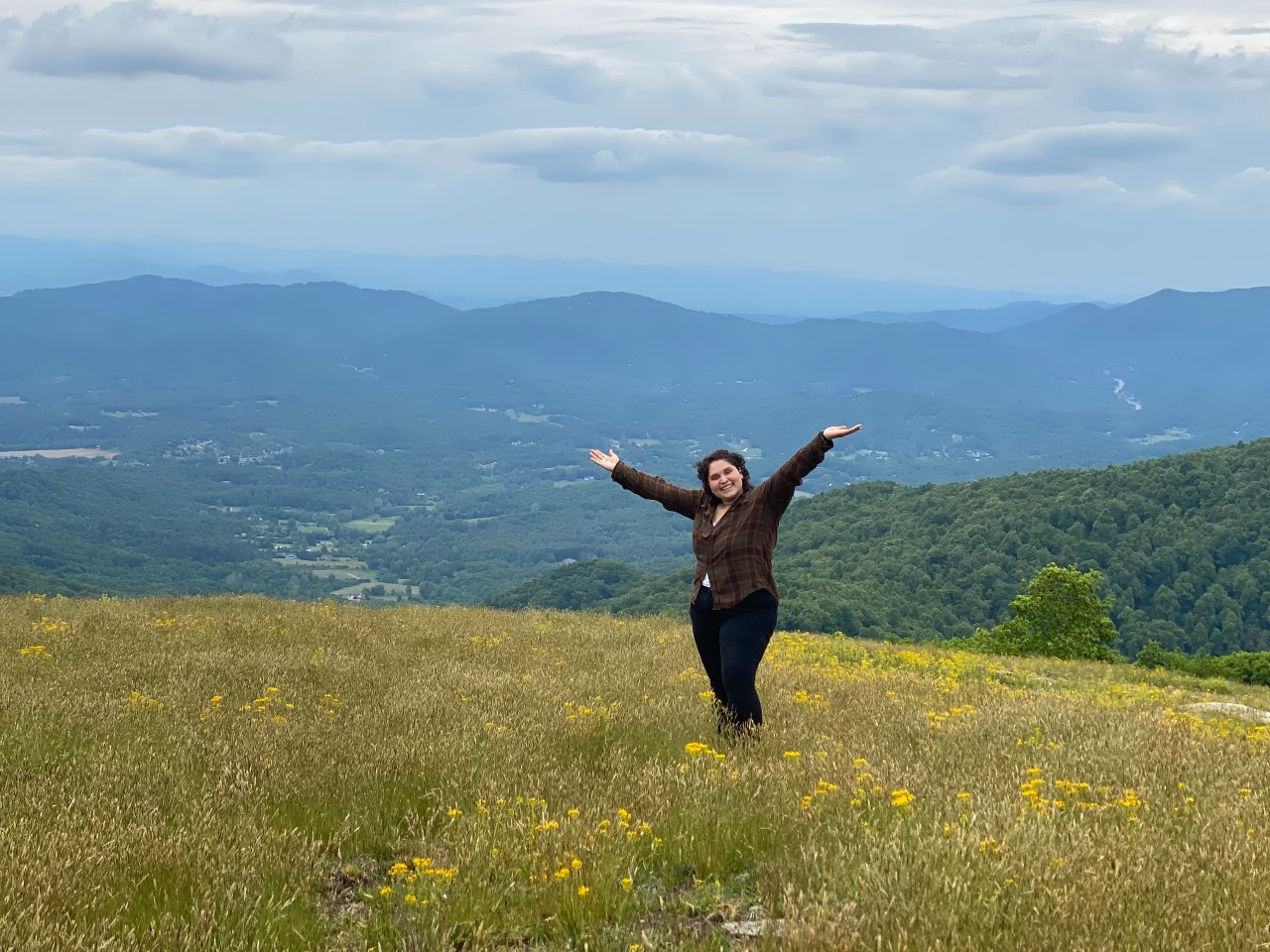
Gerton, NC
2 miles round-trip (with longer hike options)
Bearwallow Mountain is the one hike that’s featured in every Hiking Challenge—for good reason! A short hike takes you to a grassy, open mountaintop with nearly 360-degree views. You can take in panoramic vistas including Mt. Mitchell, Mt. Pisgah, the Hickory Nut Gorge, Hendersonville, and the high country of South Carolina. Bearwallow is actually part of a working farm so you may see cattle grazing on the mountaintop.
Conserving Carolina holds a conservation easement on 476 acres, ensuring that this beautiful mountain will never be developed. We also maintain the popular hiking trail. This trail was the first step toward the 100+ mile Hickory Nut Gorge State Trail that we are spearheading—now with almost 40 miles open to the public! If you want to do a longer hike, you can continue from Bearwallow to the Wildcat Rock Trail or the Trombatore Trail or even link this hike to the Strawberry Gap Trail.
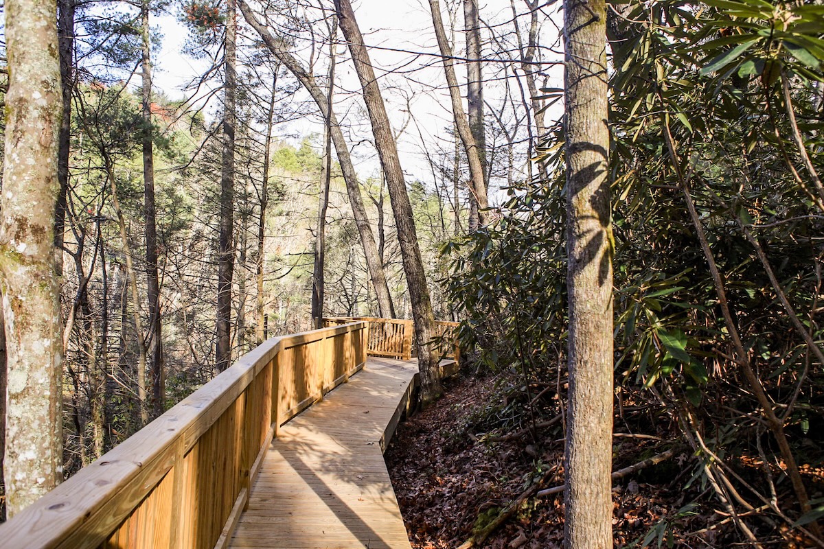
Bell Park
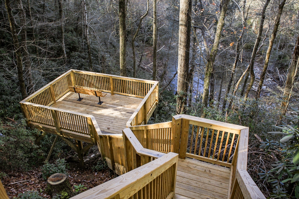
1.8 miles round trip
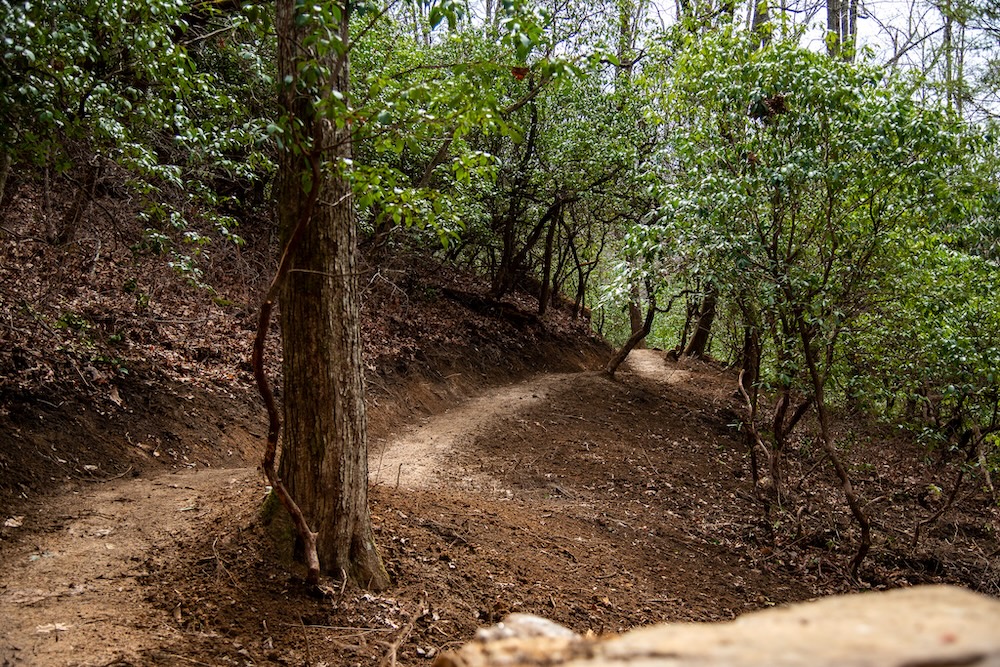
Bell Park is a new Henderson County park, opened in November 2024 in partnership with Conserving Carolina. Bell Park is located in Saluda on Spartanburg Highway (176) on the slopes above the Green River Gorge. This park offers an observation deck with a bench beside a waterfall and 1.8 miles of rolling trails through the forest. The trails are open for walking, hiking, and running.
Bell Park was named in honor of summer camp pioneers Frank and Calla Bell and continues their legacy by creating a new place for people to connect with nature.
Little White Oak Mountain

Mill Spring, NC
4 miles
The hiking trails include stream crossings through a beautiful wooded area right behind Polk Middle School. This is the first bike-optimized trail system in Polk County and you can travel the trail on foot or on mountain bikes. For the Hiking Challenge, you can take Piney Flats to Escalator, then Laurel Loop, then Ripsaw Cove loop, back down Escalator, and complete Piney Flats loop back to parking – for a total of just over 4 miles!
You also have the option of biking this trail for the Hiking Challenge, in which case you should do all of the trails at Little White Oak Mountain including the bike-only Live Wire trail.
Conserving Carolina helped save nearly 1,000 acres of land at Little White Oak Mountain that had been slated for development. This beautiful mountain is a scenic landmark in Polk County with many streams and important wildlife habitat. Now, we’re proud to see a number of projects moving forward at Little White Oak Mountain that support important community goals, from affordable housing, to wildlife habitat, to a new local park near schools.
The Ecusta Trail

Hendersonville, NC
6 miles out and back
The Ecusta Trail is the visionary transformation of a former rail line into a multi-use greenway spanning 19 miles between Hendersonville and Brevard, North Carolina. The first 6 miles of the trail are now open, inviting people of all ages and abilities to experience the region’s natural splendor by walking, running, biking, and using a wheelchair. This trail can be completed for the Hiking Challenge either by hike or bike!
If you are walking, do at least 5 total miles—so walk a 2.5 mile section out-and-back or shuttle the trail from its endpoints in Hendersonville and Horse Shoe. If you are biking, bike the whole 5.6-mile trail out and back, for a total of 11.2 miles. See a trail map here.
Conserving Carolina worked with the Friends of the Ecusta Trail to buy the rail corridor and raise the millions of dollars required for trail construction. We are thrilled to see the first section of the trail come to life and we look forward to seeing it extended all the way to Brevard!
Rumbling Bald

Chimney Rock, NC
1.5 mile loop
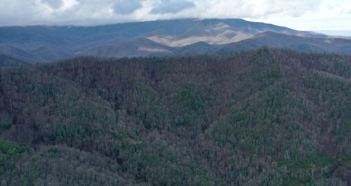
This 1.5-mile loop trail in Chimney Rock State Park takes you to the boulder fields and base of the cliffs of Rumbling Bald Mountain that towers over Lake Lure. The large parking area is about two miles from the main Chimney Rock Park entrance (so there’s no admission fee here). It’s also a favorite rock climbing location. The woodland hike has some uphill sections, but it’s easy enough for most fitness levels. It’s a great way to explore the Hickory Nut Gorge.
Views of the cliffs are best when leaves are off the trees. But in the summer, the leaves provide a shady trail to escape the heat. After you walk a short distance, you’ll come to an east / west fork that begins the loop. We like to take the right (east) fork of the trail and go counter-clockwise. After about a half mile walk, you’ll arrive at the first of the bouldering areas. You’ll see a side trail to the east boulders. Follow the sign to Cereal Buttress to stay on the loop.
Conserving Carolina helped to add thousand of acres to Chimney Rock State Park, including the astonishing World’s Edge. Conserving Carolina has also helped to protect 2,650 acres just north of the park, home to Weed Patch Mountain Trail and new trails in the works.
Cat Gap
Pisgah National Forest, NC
4.6 miles round trip
This trail follows the Cat Gap Loop Trail (#120) from the Pisgah Center for Wildlife Education. The trail may have several spots where natural springs cross and it may be muddy. There are several strenuous and steep sections that get the heart pumping and make for a great workout in the woods. Several primitive bridges take you across the river and there may be a couple of scrambles over rocks as well.
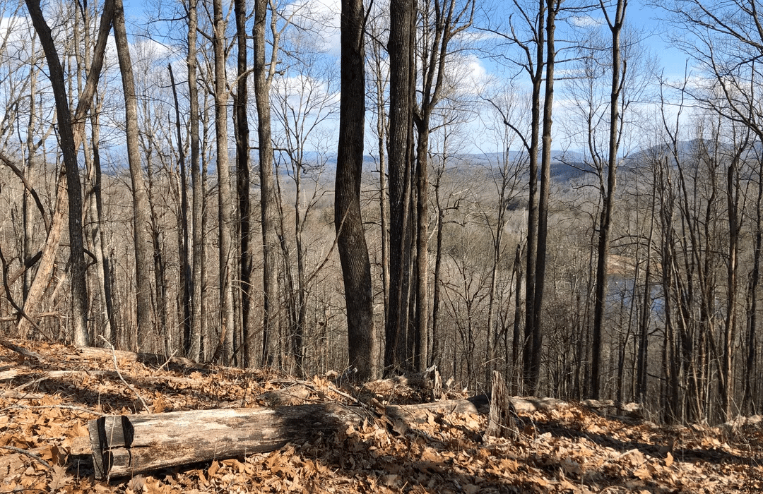
Pisgah National Forest is one of our region’s great natural treasures and Conserving Carolina is proud to have helped add numerous properties to the national forest, expanding our public lands. We have also conserved thousands of acres on the edge of the national forest, expanding a vast area of unbroken wildlife habitat and natural beauty.
Mine Mountain, Cart Trail, Laurel Ridge
DuPont State Forest, NC
5.9 miles round trip
Head out on this 5.9-mile loop trail near Cedar Mountain, North Carolina. Generally considered a moderately challenging route, it takes an average of 2.5 hours to complete. This is a popular trail for birding, hiking, and mountain biking, but you can still enjoy some solitude during quieter times of day. The trail is open year-round and is beautiful to visit anytime. Dogs are welcome, but must be on a leash. This trail can be completed for the Hiking Challenge either by hike or bike!
Conserving Carolina helped to protect much of DuPont State Recreational Forest, including the first 7,600 acres purchased in the late 1990s. We have continued to add land to the forest since that time, including a 717-acre addition that we completed in 2020, connecting DuPont to a vast corridor of conservation land spanning over 100,000 acres.
White Oak Mountain
Headwaters State Forest, NC
4.1 mile loop
Discover this 4.1-mile loop trail near Rosman, North Carolina. Generally considered a moderately challenging route, it takes an average of just under two hours to complete. This trail is great for hiking and running, and it’s unlikely you’ll encounter many other people while exploring. The trail is open year-round and is beautiful to visit anytime.
Conserving Carolina was proud to support the conservation of Headwaters State Forest, which created 6,370 acres of new public land when it opened in 2018. Part of more than 100,000 acres of protected land in North and South Carolina, Headwaters helps to provide an unbroken conservation corridor for both people and wildlife. The forest is open for hiking, hunting, and fishing, and it borders a nine-mile stretch of the Foothills Trail. It is home to numerous rare or endangered plants and animals, and it is home to native brook trout and hellbender salamanders. And its 50+ miles of crystal-clear streams flow into the French Broad River.
Share and Connect
We love to see your photos and stories! Please post with the hashtag #whitesquirrelhikingchallenge so we can keep up with your adventures. Also the Conserving Carolina Facebook group is a great place to share about our hikes and connect with other folks doing the White Squirrel Hiking Challenge.