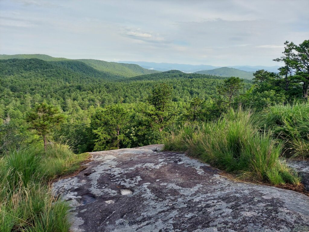
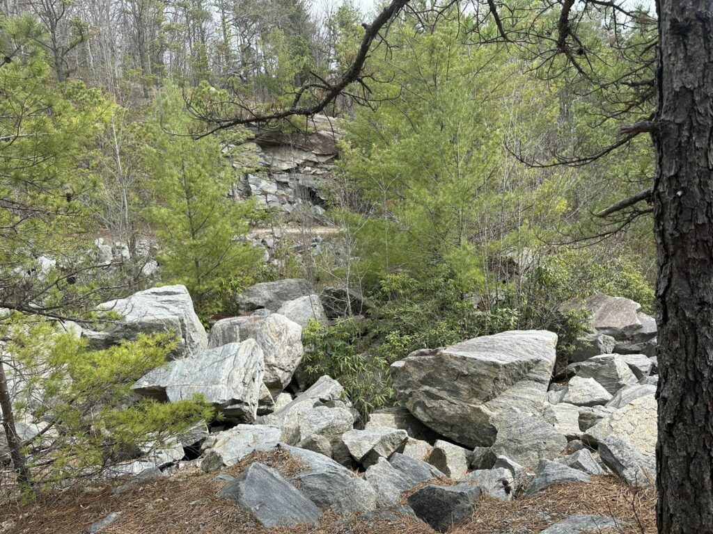
While Dupont is better know for its waterfalls, rivers, and lakes, these trails will take you through a quiet corner of the forest with a small rock quarry, a rocky bald with mountain views, and unique trails over exposed stone. This quarry is only used by the park service and is generally a quiet field of boulders and manmade cliffs. This part of the challenge begins at the Corn Mill Shoals parking area and traverses Twixt, Rock Quarry Road, and Wilkie trails. These trails will not only take you by the rock quarry but also to a beautiful rocky bald with a view of the surrounding mountains.
With over 90 miles of interconnected trails, DuPont is a fantastic place where new adventures abound. Conserving Carolina played an integral role in the creation of DuPont State Recreational Forest and has been adding land ever since, including the 717-acre Continental Divide addition completed in 2020.
This hike is part of Conserving Carolina’s and WPA’s White Squirrel Hiking Challenge 7, which takes you to 8 amazing hikes on protected land. Take the challenge to discover some great places!
Location: Cedar Mountain, NC
Length: 3.1 mile loop; round-trip
Difficulty: Moderate
Elevation Gain: 387′
Great For: Wildflowers, Wildlife, Views
Trail Map for DuPont State Forest
DuPont provides this trail map, which you can download or print before your hike.
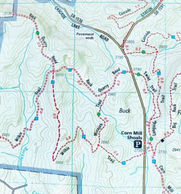
Below is a detailed look at the trails for this hike, taken from the most recent National Geographic map of the trails.
How to Get to Corn Mill Shoals Access Area
The Corn Mill Shoals parking lot is located off Cascade Lake Road in the western portion of DuPont State Recreational Forest, in Transylvania County. GPS users may enter N35.172754, W82.638713 in their units.
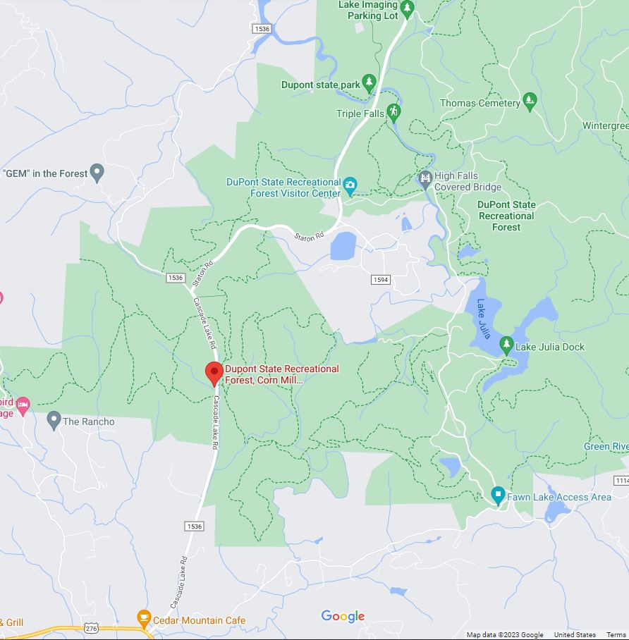
DuPont’s parking areas fill up on many weekends. We recommend arriving before 9AM or after 4PM if planning on a weekend hike. There is more parking availability on weekdays as well. There will be no roadside parking once lots are full.
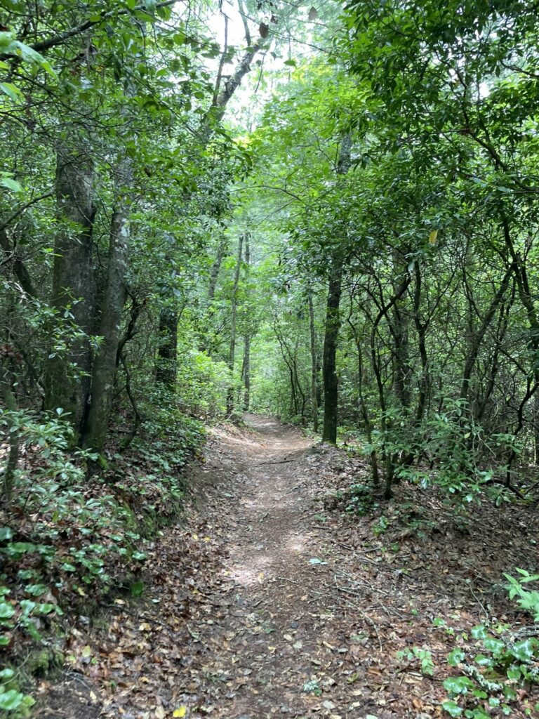
Hiking Twixt, Rock Quarry Road, and Wilkie Trails
The Twixt, Rock Quarry Road, and Wilkie trails trek is an approximate 3.1-mile round-trip, loop hike in DuPont State Recreational Forest that is moderate with an approximately 387 foot elevation gain.
Please be prepared. Bring water and snacks. You will be traveling on gravel roads and under tree shade for part of the hike but you will also be exposed to the sun on the rocky bald with a view. You may need protection from sun and insects, so bring layers, bug spray, and sunblock as appropriate. This hike is appropriate for pets and children, but pets must be leashed in DuPont State Recreational Forest. Please note that this hike is outside DuPont’s established hunting safety zones. Hunting days at DSRF are Thursday, Friday and Saturday during the hunting season calendar set by the NCWRC. All forest visitors are encouraged to wear blaze orange during hunting seasons.
Here are hiking directions:
- Park at the Corn Mill Shoals Access Area.
- Carefully cross Cascade Lake Road to pick up Corn Mill Shoals trail.
- Travel 0.1 miles before turning left onto Longside trail.
- After about 0.2 miles, Longside trail will veer to the right – stay straight to pick up Twixt trail.
- After 0.5 miles, carefully cross Cascade Lake Road again, picking up Rock Quarry Road. Here, you will begin a gentle ascent.
- After about 0.3 miles, you will pass Micajah trail on your left. Continue on Rock Quarry Road for another 0.5 miles. Keep an eye out for the rock quarry in this stretch.
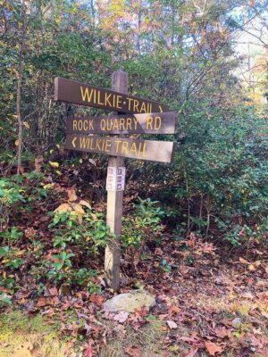
- After gaining 214 feet in elevation, you will reach the ridgeline and a 4-way trail intersection. At this 4-way intersection, two ways are labeled Wilkie Trail: straight across and left (see picture below). Turn left onto Wilkie trail.
- Continuing on Wilkie Trail, you will begin a slight descent. Soon you will find grand views of the surrounding mountains from a granitic bald.
- After traveling 1.2 miles on Wilkie trail, you will pass Micajah trail on your left. Continue straight on Wilkie trail.
- After 0.4 miles, you will reach Cascade Lake Road. Turn left and carefully hike along the road for 0.1 miles back to the parking area.
Trail Ethics in DuPont State Recreational Forest
- DuPont State Recreational Forest is open daily from 5AM to 10PM.
- Pets must be leashed and under control at all times.
- Remove all waste, including pet waste.
- Trails are multipurpose, so you may see hikers, bikers, and equestrians. Practice good trail-sharing etiquette.
- No e-bikes or motorized travel are allowed.
- Stay on the trail at all times.
- No camping or campfires.
- Areas or trails designated “No Entry,” “Do Not Enter,” or “Authorized Personnel Only” are prohibited to trail users.
- Alcohol and illegal controlled substances are prohibited.
- No collecting of any flora, fauna, rocks, or any other natural items.
- Park only in designated spots only.
How Conserving Carolina Helped Save DuPont
DuPont State Recreational Forest is a vast wooded wonderland bursting at its seams with spectacular waterfalls, scenic granite domes and inviting backcountry. An outdoor enthusiast’s paradise, it offers nearly 90 miles of hiking, mountain biking, and equestrian trails to explore its charming beauty. Rolling hills tucked between high mountains peaks host the upper reaches of the Little River and six of western North Carolina’s most stunning waterfalls.
Thanks to its beauty and accessibility, DuPont is among the state’s premiere outdoor recreation destinations. Among waterfall enthusiasts, DuPont’s falls consistently rank as the most impressive in all of North Carolina.
DuPont’s story represents a landmark achievement for land conservation in western North Carolina. With Conserving Carolina as the catalyst, the first 7,600 acres of what became DuPont State Recreational Forest was purchased by The Conservation Fund, then by the state of North Carolina, in 1996. DuPont has since grown to nearly 12,500 acres.
Over the years, Conserving Carolina has helped make numerous additions to the forest, including the new Continental Divide Tract, sometimes called the “missing link.” Completed in 2020, this addition connects DuPont to a conservation corridor that spans more than 100,000 acres along the North Carolina / South Carolina border, with exciting potential for future trail connectivity.
BECOME A MEMBER AND SUPPORT CONSERVATION!
Take the White Squirrel Hiking Challenge!
This hike is part of White Squirrel Hiking Challenge 7—an opportunity to explore eight great hikes, all in places that Conserving Carolina has helped to protect. Take all eight hikes and earn your White Squirrel patch!