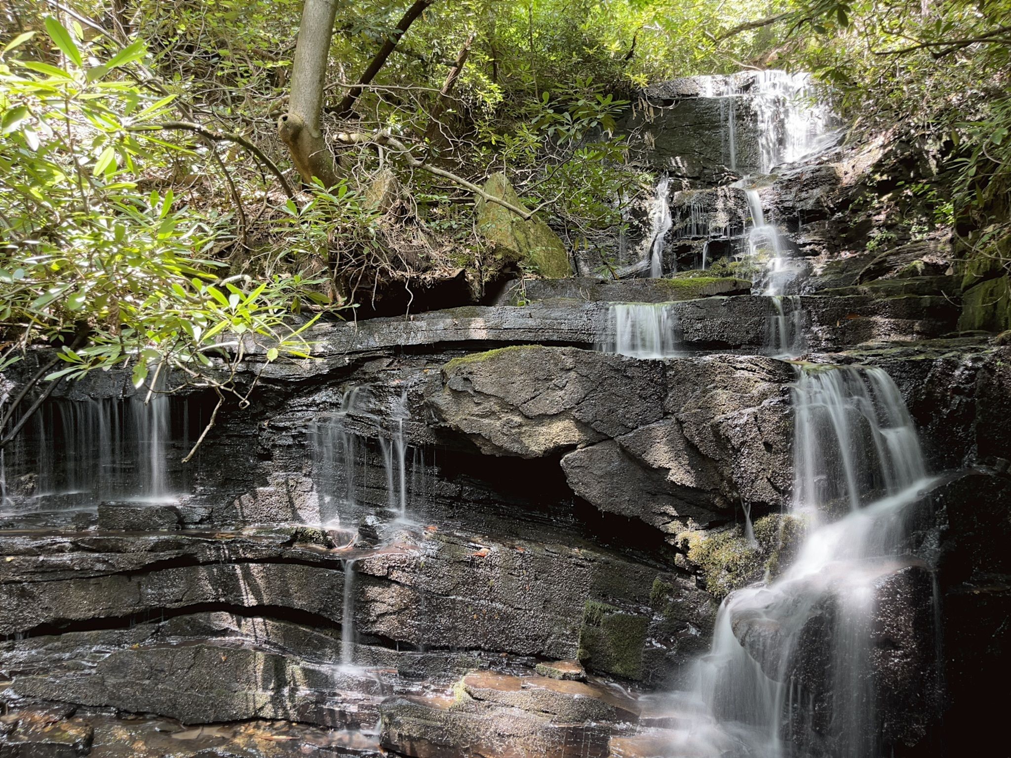
Experience the extraordinary Green River Game Lands through this moderate 4.6-mile loop hike. This hike offers a variety of scenery, with mountain views, creek crossings, lush plant life, and the beautiful Stairstep Falls.
This is a great opportunity to discover part of the Game Lands—home to a great abundance of plants and animals, including many rare species. This public land also boasts one of the highest densities of nesting birds in North Carolina. Owned by the state of North Carolina, the Green River Game Lands comprise over 14,000 acres along the Blue Ridge Escarpment in Henderson and Polk counties. There is a network of nine marked trails. Hiking this loop, you’ll traverse four of these trails.
Conserving Carolina continues to help expand the Green River Game Lands, so you can explore more of this gorgeous wilderness. We added 600 acres at Little White Oak Mountain in 2019 and 78 acres in Saluda in 2022, with more conservation underway nearby. By expanding this protected forest, we are saving wonderful places for both people and wildlife.
This hike is part of Conserving Carolina’s and WPA’s White Squirrel Hiking Challenge 7, which takes you to 8 amazing hikes on protected land. Take the challenge to discover some great places!
Location: North of Saluda, NC
Length: 4.6 mile loop
Difficulty: Moderate
Great for: Bird Watching, Wildflowers, Views, Wildlife, Waterfall
How to Get to the Green River Game Lands Loop
There is a small parking area at the Bishop Branch Trailhead off of Big Hungry Road. GPS users may enter N35.291151, W-82.324386 in their units.
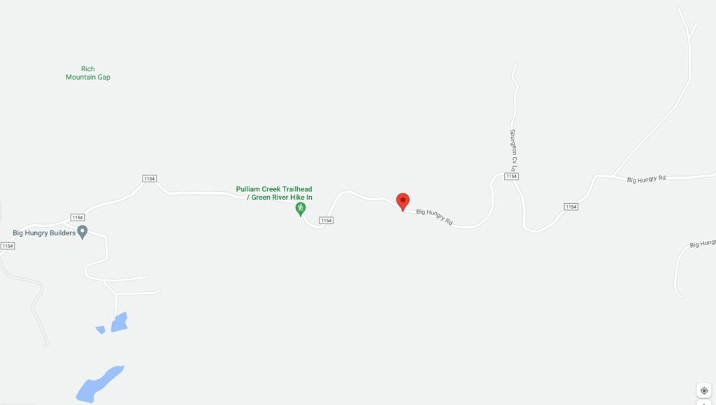
Parking and Finding the Trail
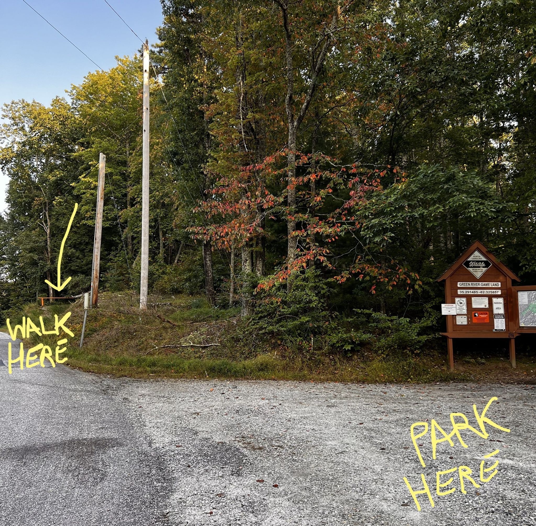
The Bishop Branch parking area is not very big, if it is full you can park along the side of Big Hungry Road. The trail starts just to the east of the trailhead and kiosk. Look for an old roadbed with a red gate (see photo below). This is the start of Bishop Branch Trail.
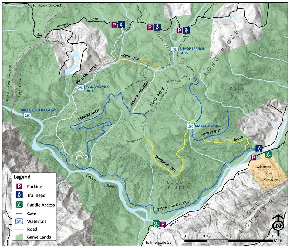
You can access a PDF of this map here to download and print to take with you on your journey, if desired.
Hiking the Green River Game Lands Loop
The Green River Game Lands Loop hike is an approximate 4.6-mile round-trip, loop hike in the Green River Game Lands and is considered moderate with an 840 foot elevation gain.
Please be prepared. Bring water and snacks. There is a mix of tree shade and areas with less tree cover. You may need protection from sun and insects, so bring layers, bug spray, and sunblock as appropriate. This hike is appropriate for pets and children, but pets must be leashed in the Green River Game Lands.
Here are hiking directions:
- Park at the Bishop Branch Trailhead parking area.
- Follow Big Hungry Road for a short distance to the east on foot to begin the trail. You’ll see an old forest road with a red gate on the right. That is Bishop Branch trail.
- Follow Bishop Branch trail (white blazes) for about 0.4 miles. When you will come to a trail intersection on your left, keep following Bishop Branch trail. (This is where you’ll return from your loop.) After another 0.2 miles, you’ll come to Rock Hop trail on your right. Continue to follow Bishop Branch trail and cross Pulliam Creek a short distance ahead. You will begin to gain a bit of elevation, traveling another 0.5 miles to the trail intersection with Bear Branch trail (blue blazes).
- Take Bear Branch trail to the left/east. Go 0.1 miles to the intersection with Long Ridge trail (an old gravel road, white blazes).
- Take Long Ridge trail to the right/south. Go 0.3 miles to the intersection with Stairstep Falls trail (yellow blazes).
- Turn left/southeast on Stairstep Falls trail, beginning a 860′ elevation decent over 0.8 miles. After this point, the trail begins to climb. Go about 0.5 miles further, crossing Stair Step Creek and viewing Stairstep Falls, just before the intersection with Turkey Gut trail.
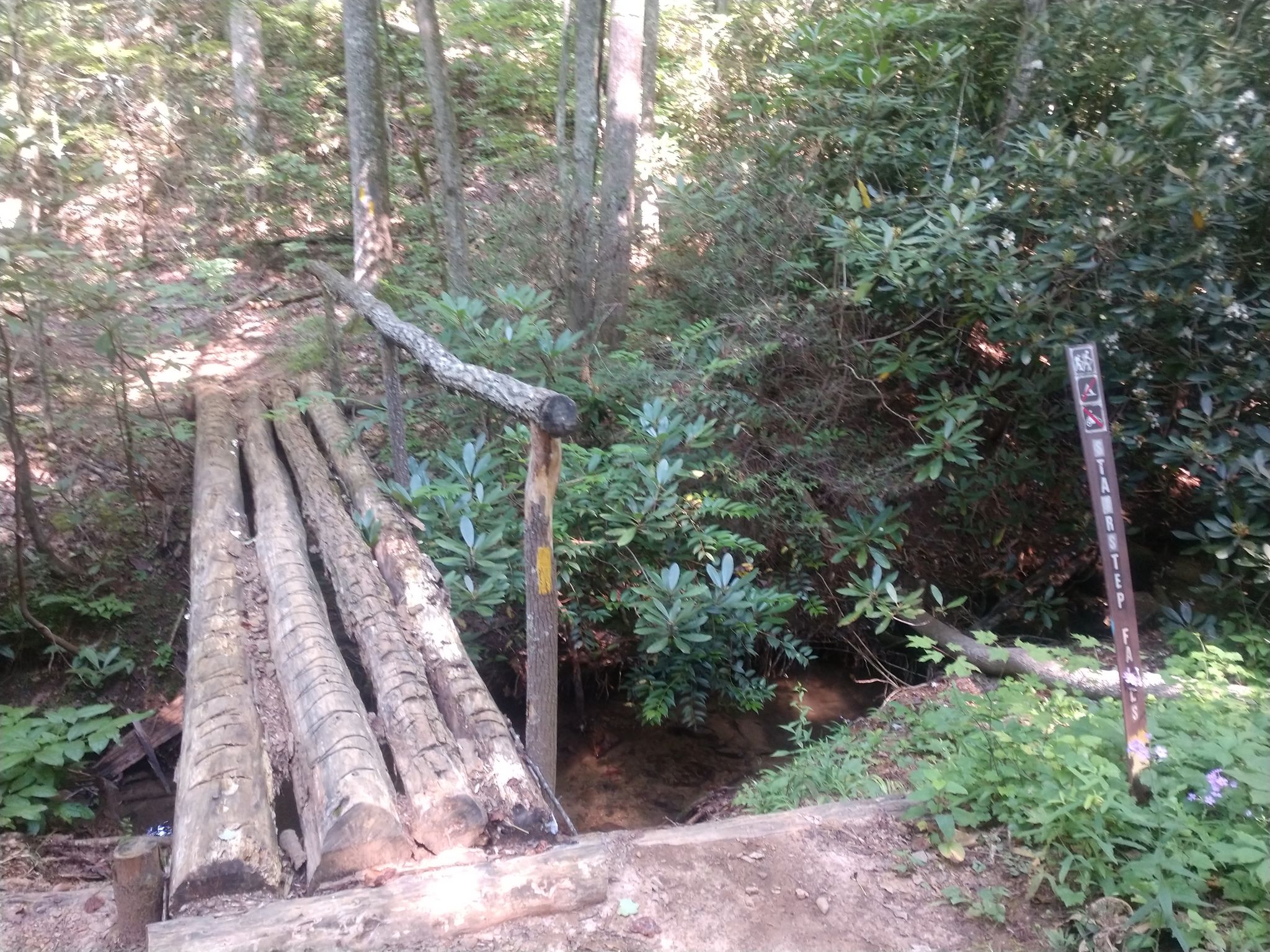
- Follow Turkey Gut trail (blue blazes) left/north, ascending, for approximately 0.7 miles where you’ll encounter a gate and intersect with Long Ridge trail, a second gate on your left.
- Here, you will get back on Long Ridge trail (only passing the gate at Turkey Gut trail) and continue north for 0.5 miles, and almost back to Big Hungry Road and the Long Ridge Trailhead.
- Near a stream crossing, pick up a trail to the left/west, following it for 0.3 miles. After about 0.1 miles on this trail, you will cross the stream again before reaching the intersection with Bishop Branch trail (blue blazes).
- Turn right/north on Bishop Branch trail, following it 0.4 miles back to the parking area.
Green River Game Lands Trail Ethics
- Trail users should be cautious during hunting season, which is generally from mid-September to mid-May.
- Pets must be leashed and under control at all times.
- Remove all waste, including pet waste.
- No ATVs or motorcycles permitted
- No horses are allowed.
- Stay on the trail at all times.
- Camping is allowed in the designated privative camping area only.
- No collecting of any flora, fauna, rocks, or any other natural items.
New Land Added to the Green River Game Lands
As part of Conserving Carolina’s White Squirrel Hiking Challenge 7, this hike celebrates conservation of our gorgeous WNC and Upstate SC mountains.
Conserving Carolina continues to add land to the Green River Game Lands, so we all have places of wonder to explore. We added 600 acres at Little White Oak Mountain in 2019 while also expanding a local park, so all of this protected land links to Polk County Middle School. We also worked with a group of neighbors to protect land in Saluda that was once targeted for a shooting range. The ultimate vision is to protect almost 300 acres. In 2022, 78 acres of this land was added to the Game Lands.
BECOME A MEMBER AND SUPPORT CONSERVATION!
Take the White Squirrel Hiking Challenge!
This hike is part of White Squirrel Hiking Challenge 7—an opportunity to explore eight great hikes, all in places that Conserving Carolina has helped to protect. Take all eight hikes and earn your White Squirrel patch!

