This hike is part of the WPA & Conserving Carolina White Squirrel Hiking Challenge 5. One of the best day hikes in Western North Carolina, Bearwallow Mountain offers panoramic views in almost every direction.

Take in Panoramic Views
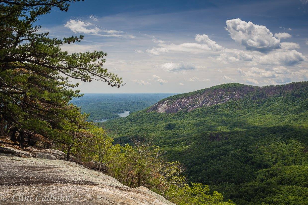
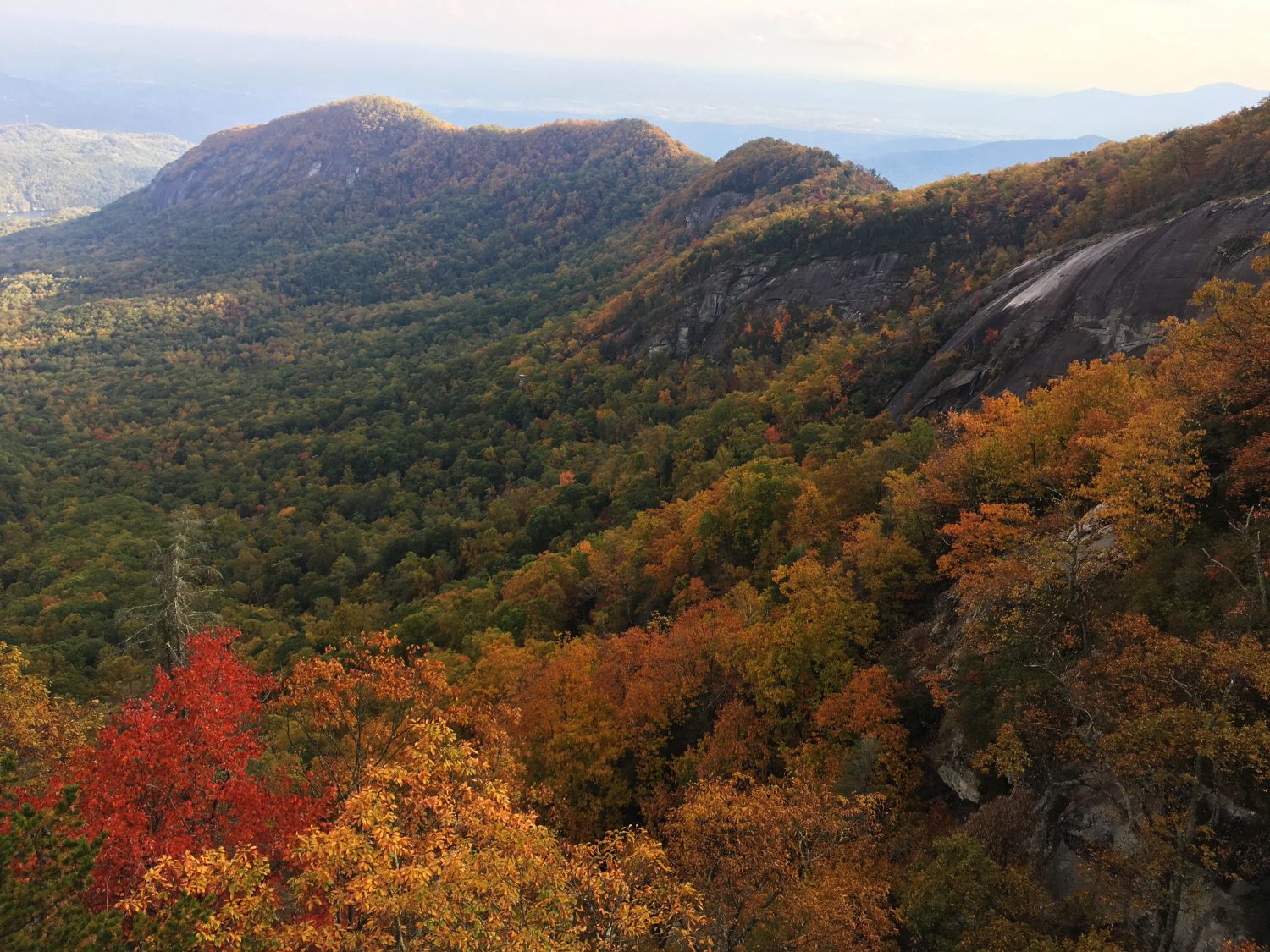
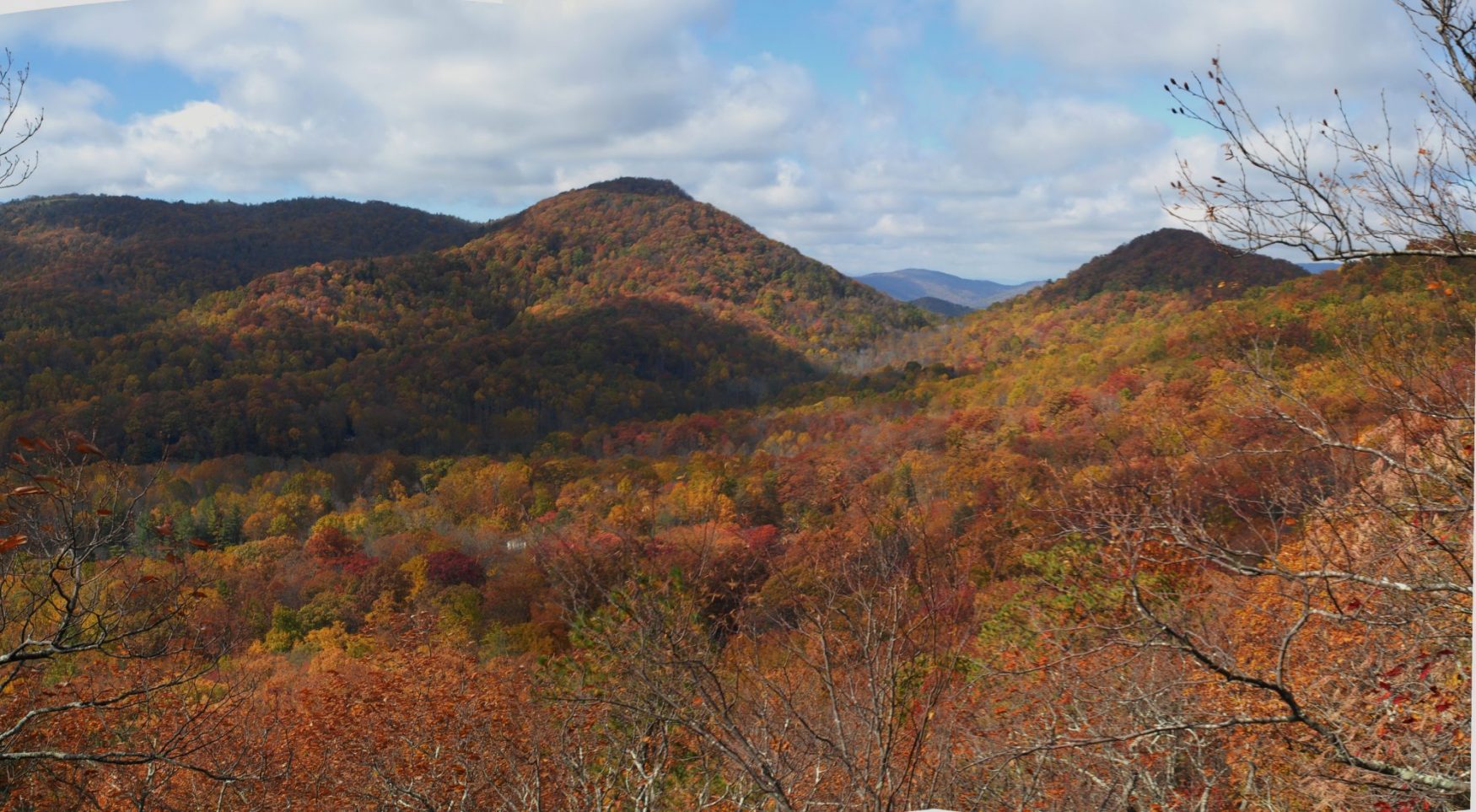
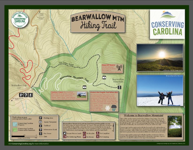
At 4,232 ft. above sea level, Bearwallow Mountain stands as the highest peak in the widely-visible Bearwallow Highlands range. Straddling the Eastern Continental Divide, it forms the part of the upper rim of the Hickory Nut Gorge. Crowned with a scenic grassy meadow at its summit, the mountain features a nearly 360° view that encompasses some of the southern Appalachians’ highest peaks, including Mt. Mitchell in the Black Mountains and Mt. Pisgah in the Great Balsams range. Its breathtaking vista also includes a birds-eye view of Hickory Nut Gorge, downtown Hendersonville, and the lowlands of South Carolina. A historic fire lookout tower occupies the summit, as do grazing cattle who call the mountaintop home.
Conserving Carolina started protecting Bearwallow Mountain in 2009, with a conservation easement on 81 acres at the summit, forever protecting it from mountaintop development. Conserving Carolina protected an additional 85 acres along the high elevation ridgeline in 2013, with 5 more acres protected in 2014. An additional 300 acres were permanently conserved in 2017. That brings the total to nearly 500 acres protected forever!
Conserving Carolina protects Bearwallow Mountain via conservation easements in partnership with its private landowner. A conservation easement is a voluntary legal agreement between a landowner and a land trust that permanently limits certain uses of the land in order to protect its conservation values, including natural heritage, water quality, scenic views, wildlife habitat, and many more. It allows landowners to continue to own and use their land—like grazing cattle atop Bearwallow Mountain—and they can also sell it or pass it on to heirs.
In 2011, Conserving Carolina constructed a new public hiking trail to the summit of Bearwallow Mountain with the help of the Carolina Mountain Club, REI Asheville, and community volunteers. This trail is part of our long term vision for the 130-mile Hickory Nut Gorge State Trail.
CHALLENGE: Hike to the Summit of Bearwallow Mountain
Primary Route: Hike the popular Bearwallow Mountain Trail to the scenic summit bald
Hiking Distance: 2.0 miles round-trip
Elevation Gain: 537 feet
Difficulty: Moderate
Trailhead: Click here to enter your address and receive turn-by- turn directions to the trailhead. GPS users may enter N35.4607, W-82.3681. The trailhead is at Bearwallow Gap, located at the crest of Bearwallow Mountain Road where the road surface transitions between pavement and gravel. A wooden entryway marks the start of the trail.
Hiking Directions
Once inside the gate, locate the trail and the trailhead kiosk to the right of the gravel road. The trail switchbacks several times to begin its climb up the slopes of Bearwallow Mountain. After a sharp switchback at 0.5 mi., the path levels out to provide a breather as it curves around Bearwallow’s western ridge. Once on the mountain’s northern slopes, climb several more sets of rock stairs at 0.7 mi. At 0.8 mi., the trail emerges into Bearwallow’s beautiful mountaintop meadow. In summer, you will share the grassy bald with cattle. Intersect the gravel road just beyond and walk to its end atop the summit and fire tower at 1.0 mi.
Alternative Routes: Hike the gravel access road to the summit (0.7 mi.), or use the trail and the road to make a loop hike (1.7 mi. round-trip).
Bearwallow Mountain Trail Map
About the WPA & Conserving Carolina Hiking Challenge
![]() The popular White Squirrel Hiking Challenge is back! Take the challenge and go on 8 hikes, all on lands protected by Conserving Carolina. If you complete all 8 hikes and you are a Conserving Carolina member, that makes you a Hiking Challenge 5 Champion. You will earn an awards package, including your white squirrel patch and a $10 gift card to Mast General Store in Hendersonville. Most importantly, you get to experience 8 great places and deepen your personal connection to land conservation.
The popular White Squirrel Hiking Challenge is back! Take the challenge and go on 8 hikes, all on lands protected by Conserving Carolina. If you complete all 8 hikes and you are a Conserving Carolina member, that makes you a Hiking Challenge 5 Champion. You will earn an awards package, including your white squirrel patch and a $10 gift card to Mast General Store in Hendersonville. Most importantly, you get to experience 8 great places and deepen your personal connection to land conservation.
Hiking Challenge 5 is brought to you by Witherspoon, Platt, and Associates (WPA)—a full service, conservation-oriented real estate brokerage connecting people with the beauty, history, and culture of Western North Carolina through both the built environment and land protection.

See All the Hikes