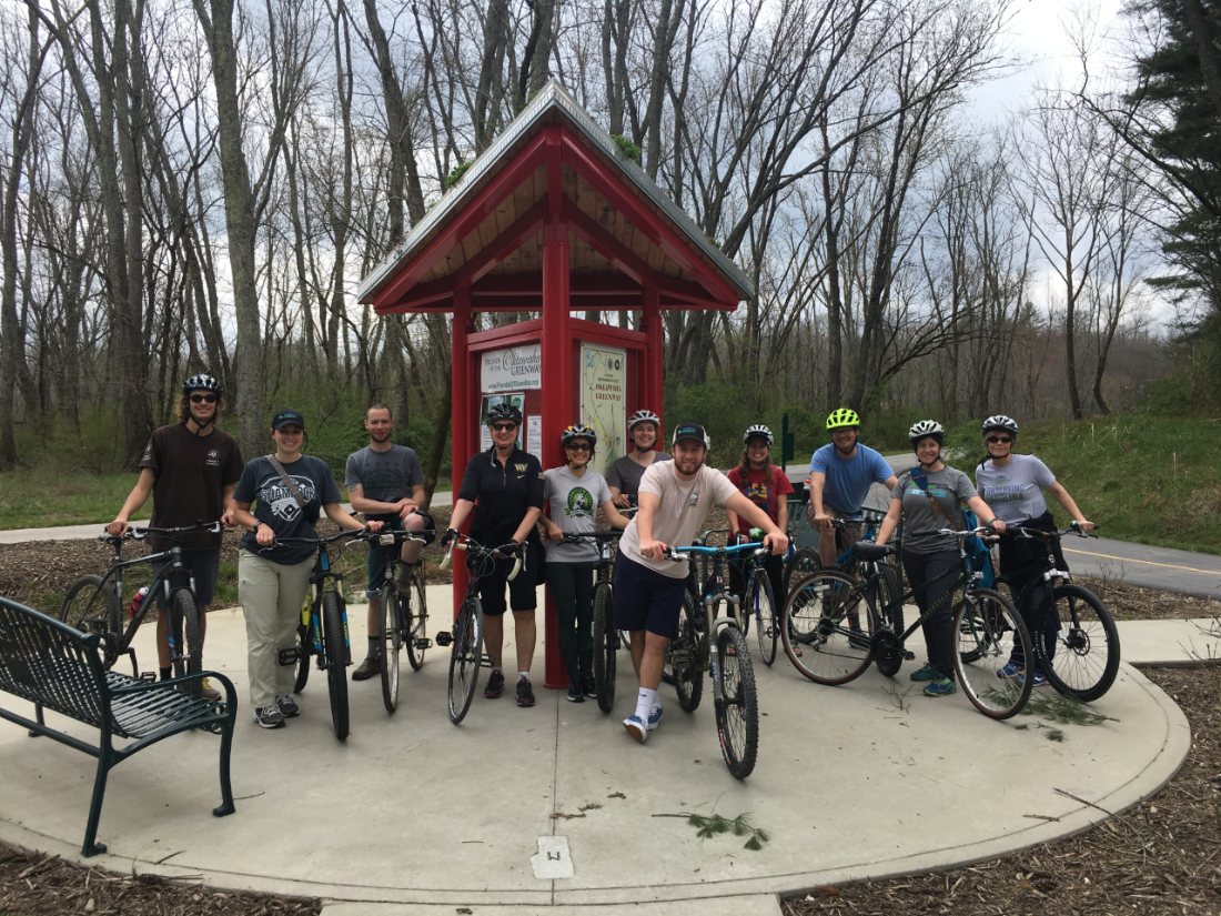
This hike is part of the WPA & Conserving Carolina White Squirrel Hiking Challenge 5. It takes you to two highlights on the award winning Weed Patch Mountain Trail—recognized as one of the best new trails in the country! You can enjoy this hike on its own or combine it with the Grey Rock hike for a big day out on Weed Patch Mountain. If you’re up for a challenging mountain bike ride, you can also bike this trail.
New Access in Chimney Rock State Park
The new Weed Patch Mountain Trail, which opened in 2018, offers exciting backcountry adventures for hikers, mountain bikers, and rock climbers. The 8.6 mile trail traverses rugged mountain terrain through a remote wilderness area in the Town of Lake Lure’s Buffalo Creek Park.
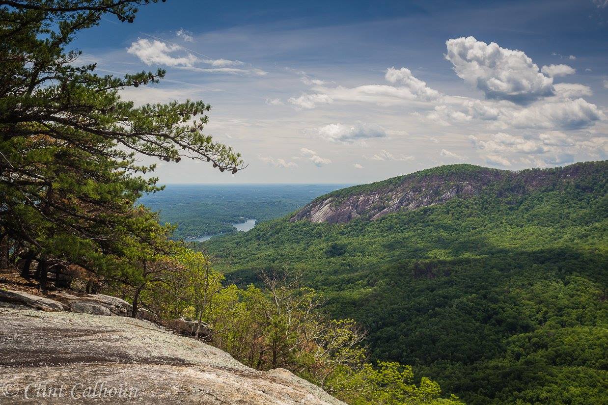
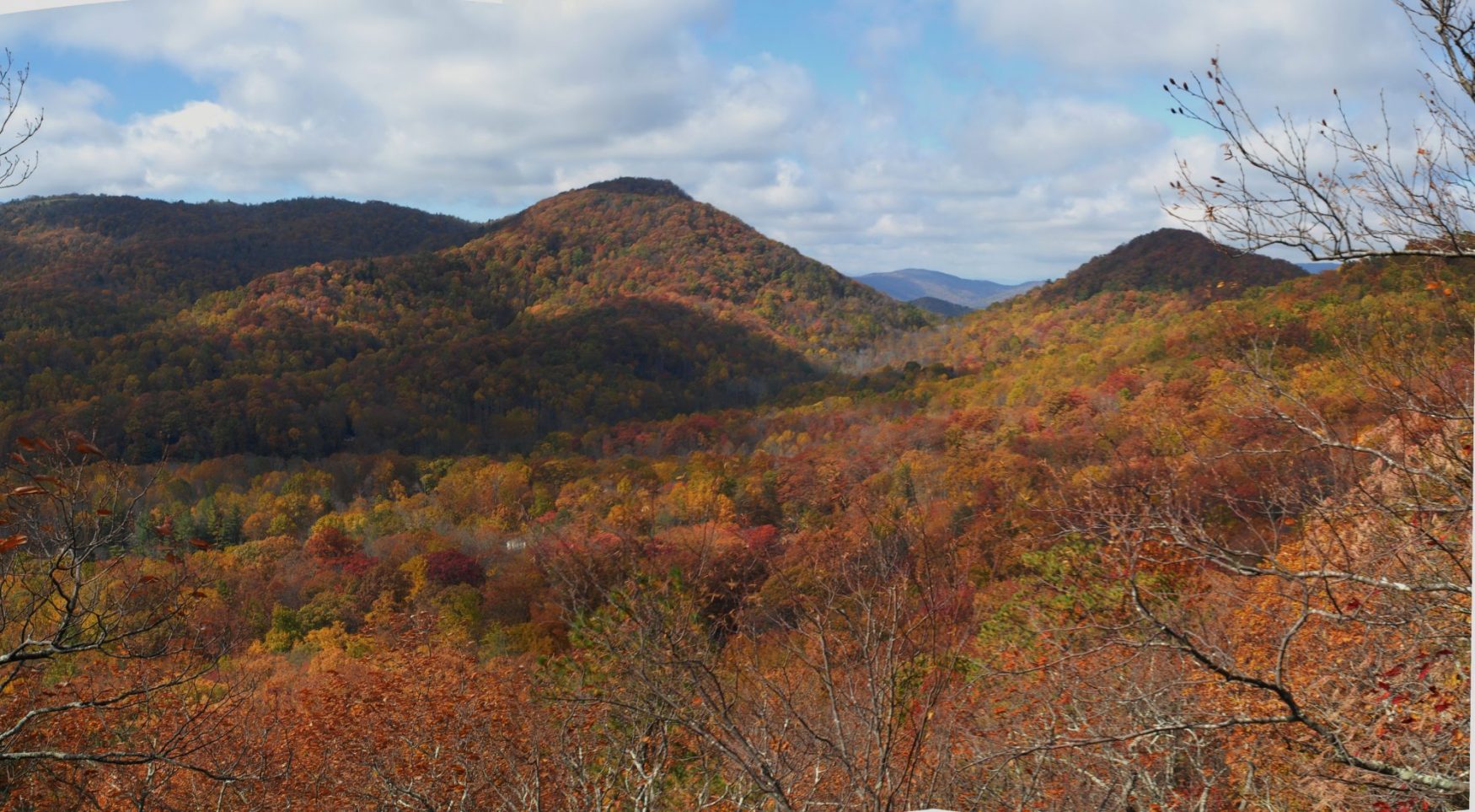
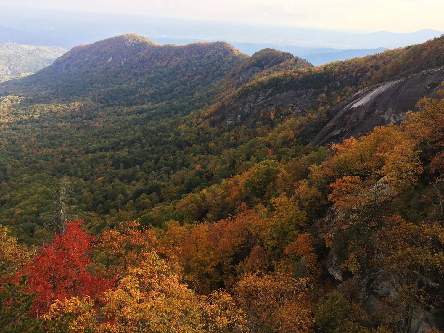
Along the way, you’ll find yourself at rock outcrops with spectacular long-range views, as well as pristine mountain streams and an old growth forest. The trail is designed for hiking and mountain biking and a spur trail creates the first access to Eagle Rock in Chimney Rock State Park, a rock climbing destination. This trail connects to the Buffalo Creek Loop Trail.
Conserving Carolina partnered with the Town of Lake Lure to protect over 1,500 acres at Buffalo Creek Park—making it one of the largest local parks in North Carolina. This land was slated for development, but during the recession, we were able to purchase the property out of bankruptcy. This allowed us to save a stunning tract of backcountry wilderness and open it to the public for recreation!
Conserving Carolina protected the land forever with a conservation easement and sold it to the town for a public park. We designed and built the 8.6 mile trail to high standards of sustainability, in order to prevent erosion, minimize needs for future maintenance, and enhance people’s experience on the trail. Our volunteer trail crews were instrumental in creating this state-of-the-art backcountry trail. The Weed Patch Mountain Trail is part of our vision for the 130-mile Hickory Nut Gorge State Trail network.
In 2019, the national Coalition for Recreational Trails honored Weed Patch Mountain Trail with its annual achievement award in the category of trail design and construction. It was the second year in a row that a Conserving Carolina trail has won this national award. Learn more.
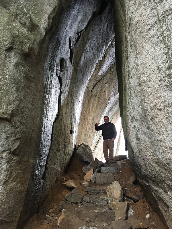
CHALLENGE: Hike to Eagle Rock and the Tunnel on the Weed Patch Mountain Trail
Primary Route: Hike to Eagle Rock & the Tunnel on the Weed Patch Mountain Trail
Hiking Distance: 3.6 miles round-trip
Difficulty: Moderate
Trailhead:
A small parking lot at the end of Shumont Road (off of Highway 9 in Bat Cave) with limited space is available at the upper end of the Weed Patch Mountain Trail, near Eagle Rock inside Chimney Rock State Park. Limited parking is available on a first come, first serve basis. Please carpool in order to make the maximum use of this lot!
Click here to enter your address and receive turn-by- turn directions to the trailhead. GPS users may enter N35.472234, W-82.242326 in their units.
The Weed Patch Mountain Trail can also be accessed from the Buffalo Creek Park enterance/trailhead in Lake Lure at 2191 Buffalo Creek Rd, Lake Lure, NC 28746.Take the Buffalo Creek Loop Trail to get to Weed Patch Mountain Trail.
Hiking Directions
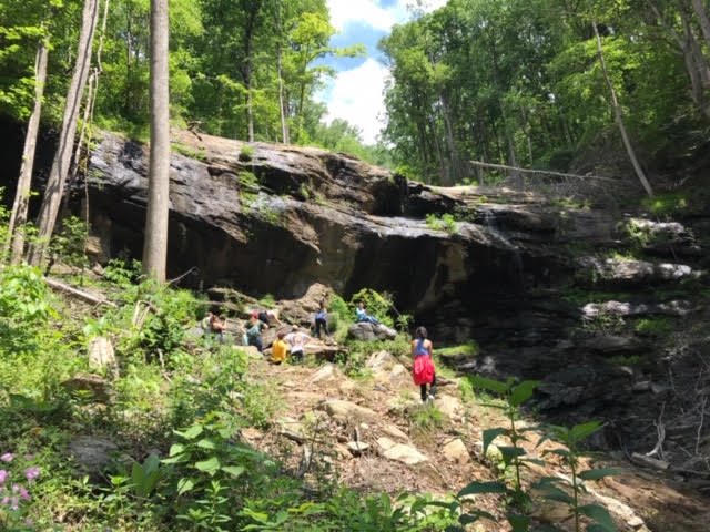
From the gravel permit parking area, walk beyond the gate and up the dirt road, ascending slightly. At 0.4 miles, the road reaches a T-junction. Follow signs for the trail and turn left, and proceed on a rough, narrow footpath to a signed junction where the Weed Patch Mountain Trail begins on the left. First proceed straight just a few yards to reach Eagle Rock, the rock formation directly ahead. Climb up the rocks for the best view.
To reach The Tunnel, return a few yards to that signed junction and turn onto the WPM Trail. Descend several switchbacks through a rhododendron and mountain laurel forest—which burned significantly in the 2016 Party Rock Forest Fire—to reach a signed junction with the Tunnel Trail on the right at 1.7 miles from the parking area. Turn right to follow the Tunnel Trail , going through the Tunnel itself and reaching the base of Eagle Rock just beyond, at 1.9 miles.
About the WPA & Conserving Carolina Hiking Challenge
![]() The popular White Squirrel Hiking Challenge is back! Take the challenge and go on 8 hikes, all on lands protected by Conserving Carolina. If you complete all 8 hikes and you are a Conserving Carolina member, that makes you a Hiking Challenge 5 Champion. You will earn an awards package, including your white squirrel patch and a $10 gift card to Mast General Store in Hendersonville. Most importantly, you get to experience 8 great places and deepen your personal connection to land conservation.
The popular White Squirrel Hiking Challenge is back! Take the challenge and go on 8 hikes, all on lands protected by Conserving Carolina. If you complete all 8 hikes and you are a Conserving Carolina member, that makes you a Hiking Challenge 5 Champion. You will earn an awards package, including your white squirrel patch and a $10 gift card to Mast General Store in Hendersonville. Most importantly, you get to experience 8 great places and deepen your personal connection to land conservation.
Hiking Challenge 5 is brought to you by Witherspoon, Platt, and Associates (WPA)—a full service, conservation-oriented real estate brokerage connecting people with the beauty, history, and culture of Western North Carolina.

See All the Hikes